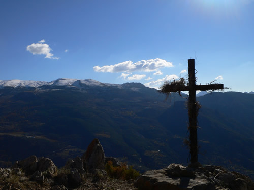
Güéjar Sierra is truly the end of the road. After winding your up from Granada, the hiking opportunities are obvious: Steep rugged mountains rise on all sides, and straight ahead are the mighty North Faces of the highest peaks of Sierra Nevada, rising to almost 3500m.
Shady day-hikes in the river valley are a welcome break from the high Andalusian summer temperautures; steep rugged trails can quickly take you to altitudes allowing amazing views of Sierra and infinite multi-day adventures begin in Güéjar Sierra!
We have been hiking around the Güéjar area for the last ten years, slowly creating a mental map of the extremely convoluted deep cut valleysand finding our favourite ways through, as well as often finding ourselves neck-deep in razor-sharp brambles as the sun goes down…
Nowdays, of course, you no longer need to risk a night in a thicket providing you have your adequately charged smartphone and all maps saved for offline viewing when the signal gets patchy, which it really does in the Sierra Nevada. But when those circumstances change by means of, for example, a leaky waterbottle above the phone in your pack it’s worth having studied your maps properly or, better still hired a guide to get you straight to the good stuff.
We would like to share some of our favourite hikes; this is by no means an exhaustive lists, as there are other sites, like the fabulous wikiloc, which has a vast database of routes and their gps tracks etc. If you like the sound of these hikes, make sure to study them carefully on such a site, or better still, get yourself a copy of these maps, to save you squinting at your iphone under the gleaming skies of the sierra:
For routes around Güéjar Sierra:
Instituto Geográfico Nacional hoja 1027-I
Instituto Geográfico Nacional hoja 1010-III
For Routes into the Sierra Nevada National Park:
Mapa oficial de Parque Nacional de Sierra Nevada.
Here are a few walks to get you going!